


Ammendale Voting District, Craig County, Virginia
About
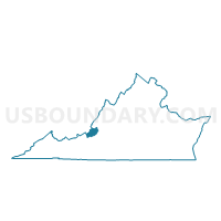
Outline

Summary
| Unique Area Identifier | 681370 |
| Name | Ammendale Voting District |
| County | Craig County |
| State | Virginia |
| Area (square miles) | 59.59 |
| Land Area (square miles) | 59.41 |
| Water Area (square miles) | 0.17 |
| % of Land Area | 99.71 |
| % of Water Area | 0.29 |
| Latitude of the Internal Point | 37.43914410 |
| Longtitude of the Internal Point | -80.16650190 |
Maps


Graphs
Select a template below for downloading or customizing gragh for Ammendale Voting District, Craig County, Virginia


Neighbors
Neighoring Voting District (by Name) Neighboring Voting District on the Map
- A-1 Voting District, Montgomery County, VA
- Asbury Voting District, Botetourt County, VA
- Catawba Voting District, Roanoke County, VA
- Court House Voting District, Craig County, VA
- Givens And Reynolds Store Voting District, Craig County, VA
- Marshalls Store Voting District, Craig County, VA
- McGuire's Store Voting District, Craig County, VA
- North Mountain Voting District, Craig County, VA
- Town Hall Voting District, Botetourt County, VA
Top 10 Neighboring County Subdivision (by Population) Neighboring County Subdivision on the Map
- Catawba district, Roanoke County, VA (19,399)
- District A-01, Montgomery County, VA (13,034)
- Amsterdam district, Botetourt County, VA (7,596)
- Fincastle district, Botetourt County, VA (6,753)
- Simmonsville district, Craig County, VA (1,018)
- New Castle district, Craig County, VA (1,016)
- Craig Creek district, Craig County, VA (1,003)
Top 10 Neighboring Unified School District (by Population) Neighboring Unified School District on the Map
- Montgomery County Public Schools, VA (94,392)
- Roanoke County Public Schools, VA (92,376)
- Botetourt County Public Schools, VA (33,148)
- Craig County Public Schools, VA (5,190)
Top 10 Neighboring State Legislative District Lower Chamber (by Population) Neighboring State Legislative District Lower Chamber on the Map
- State House District 19, VA (78,345)
- State House District 12, VA (75,683)
- State House District 8, VA (74,460)
Top 10 Neighboring State Legislative District Upper Chamber (by Population) Neighboring State Legislative District Upper Chamber on the Map
Top 10 Neighboring 111th Congressional District (by Population) Neighboring 111th Congressional District on the Map
Top 10 Neighboring Census Tract (by Population) Neighboring Census Tract on the Map
- Census Tract 403.02, Botetourt County, VA (7,567)
- Census Tract 501, Craig County, VA (5,190)
- Census Tract 301, Roanoke County, VA (3,802)
- Census Tract 213, Montgomery County, VA (3,571)
Top 10 Neighboring 5-Digit ZIP Code Tabulation Area (by Population) Neighboring 5-Digit ZIP Code Tabulation Area on the Map
- 24060, VA (53,311)
- 24175, VA (8,818)
- 24090, VA (4,781)
- 24127, VA (4,261)
- 24128, VA (1,872)
- 24070, VA (1,363)